Our first stop after we cross the state line is the
Southeast Wyoming Welcome Center, a beautifully done information center and rest area. I did not take the camera in with us, and really should have, certainly this is one of the best information centers we been to. The east side of Wyoming is known as the
High Plains.

And it is
windy on the plains, even the cattle are taking shelter behind the wind breaks. The dancing waves of grass extend to the horizon. If we were not driving it would be a great time for kite.


My favorite little Canon G15 point-and-shoot camera that I left on the dash of the RV at the VC is now cooked. The remaining pictures will be taken with the much heavier Lumix.
At the VC we learned
Fort Laramie is the first settlement in Wyoming, now a National Historic Site, and it’s along our route. At the confluence of the
Laramie and
North Platte rivers, some 50,000 arrangements passed this way either on the Oregon Trail, or to finds gold in California, or to the Mormon settlements growing around Salt Lake, or a different life. And the Army presence also grew, as did conflicts with local Indians.
I'll toss in a plug of
J.Dawg who is now blogging the Oregon Trail, I'm just crossing over it.
We arrive late afternoon and it still 98F as we walk around the grounds. The
NPS has restored some buildings that are now open for visitors to observe what life was like during the time of westward expansion.

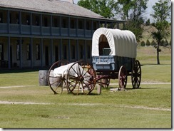


As westward expansion continued the fort grew. New construction was built on the previous foundations as the fort grew.

The
treaty of 1868 was signed here deeding all the Black Hills to the local tribes for all time. In addition to assisting travelers the Army duties now included protecting Indian Territory, but fur trapping and prospecting continued. The
1874 Black Hills Expedition led by
George Custer (yes that Custer) led a large (1000+) troops into the Indian Territory of the Black Hills for the proposed purpose of mapping, but most historians now consider mineral exploration as a priority as rumors of gold were spreading.
A bridge was built over the Laramie River to allow the Army response time to be decreased when they were needed.


The
Oregon Trail Ruts along the North Platte River were created when the trail was forced away from the river and crossed a ridge of soft sandstone.


For sure Wyoming has wind! lots of it, but it also has coal. Wyoming is the nation’s
energy leader, producing 3 times more coal than West Virginia. The long coal trains run day and night. I would not want to see these vast expanses of plains covered with windmills, but bet this wind could power the entire nation!
The wind did do us a favor by blowing the heatwave we’ve been trapped in, to someplace else! It’s a cool mid-60s when we wake up at
Devils Tower National Monument. The The
Belle Fourche Campground within the Monument is full, but the
KOA just outside has space. The entrance sign is within the park boundaries, while I am a few feet away taking this picture from the KOA, it s that close.

The tower literally does just jump up out of the grasslands.


The hiking at Oregon Pipes and Elephant Butte was done in sandals, it feels good to lace up the boots for a bit more of a challenge. The trailhead for the 2.8 mi
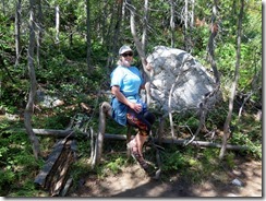
Red Beds Trail loop is just past the entrance station. The trail gets its name from the red sandstone along the Belle Fourche River and climbs quickly 500’ to the base of the tower. Notice Fran has her jacket on … it was cool when we started.


At the Visitors Center the 1.3 mile (paved)
Tower Trail is easily the most popular in the park. While we watched 3 tour buses unloaded their passengers, English was no longer the common language.
It is permitted to boulder scramble, but not to climb above the boulder field. The kids made it look fun, but most adults followed the paved path. Several native tribes still consider this sacred ground, leaving prayer beads and prayer cloth on the trees.


The tower was first climbed by the use of a
wooden ladder in 1893. A small portion still remains.


Just before the halfway point is a nice view of the tower and of the grasslands below.


The two deer not far off the trail seemed oblivious to the commotion of the bus loads now blocking the trail for selfies with them in the background.


After completing the Tower Loop we again pick up the Red Beds Trail to finish its loop back to the campground. The trail starts wide, with an easy climb through the Ponderosa Pines.


But soon descended steeply into the grasslands. Looking back up the trail it is the steepest section of the hike.


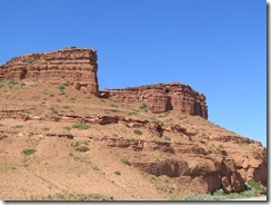
The grassland gives way to the red sandstone, almost as brilliant as that seen as
Bryce – but on an itty-bitty scale


We return to the bridge and the campground to find it filled with
Chevrolet Cameros.
Sturgis is having a
Camaro Rally this weekend. We just might swing by a take a look several hundred of them tomorrow.


The KOA is pretty typical with some great sites (ours!) some not so great. Big rigs can pull through, little rigs, like ours, can back in. Our site is water/electric (50Amp) for $52, 30Amp is all we need but none were available. Adequate store and restaurant, but lame WiFi. The WiFi reaches the whole camp, but is shared via satellite to the rest of the world. The location is perfect, as is the walk to Devils Tower on quiet trails.