Welcome!

Welcome and thanks for stopping by.
My reference links will open in a new tab.

If you have any corrections, suggestions, comments please use the Comments at the end of the post.
I do respond to all comments. - Thanks!
Showing posts with label Mission Trails. Show all posts

January 11, 2018

After it rains – where to hike in San Diego

… Waterfalls!  There are quite a few seasonal waterfalls within San Diego County.  I've listed a few of the more urban ones.

Los Peñasquitos Canyon Preserve

If we were home this week I suspect I’d come up here to check out the falls.
IMG_3659IMG_1030

Peñasquitos (meaning little cliffs) contains the closest waterfall to San Diego.  I prefer to hike west to east up the canyon, where is easy FREE parking, rather than the crowded pay parking at the east end of the canyon. I’ve blogged this route HERE.

The canyon and waterfalls can also be accessed from the Del Mar Mesa Preserve. I’ve blogged this route HERE.

Cedar Creek Falls

IMG_2035IMG_2037

Really the best if not only time to consider doing this is after a decent rain. This is probably the best known of the San Diego waterfalls, so popular that permits are required to do this day hike. In my blog on this hike HERE, I also have the link to obtain a permit.  I checked and there are permits available!

Mission Trails Regional Park

This would be my second choice for a local waterfall.  This probably should be highest on the list since I have not yet seen water at the falls …
IMG_2511IMG_2522

At the north end of Oak Creek there is a seasonal waterfall, almost right under highway 52.  When we were here with the grand-girls last February there was more water in Oak Creek than I’d seen in some time.  I’ve blogged the adventure HERE.


The snow birds that are now in the Anza Borrego area have a few options also.

Maidenhair Falls

The trail to Maidenhair Falls can be hiked up from Hellhole Canyon or down from Pena Spring. As the Nimble Hiker noted in their attempt to locate the falls from the canyon, it’s pretty hard to find without water flowing. You can find their details on Oh, the Places They Go! HERE.

You can find my route, which is down to the falls from Pena Spring HERE.  Just follow the water to the top of the falls, and then it’s a rock scramble down.
DSC01105

Coyote Canyon

DD 2nd crossing
My dad and his dog, Patsy, at the second crossing.  This was his last trip up Coyote Creek, I’ve scattered both their ashes off the eastern side of Fonts Point where they can enjoy the sunset.

After a rain Coyote Creek will be flowing deep into Coyote Canyon before joining the aquifer. This is an adventure that requires a capable 4x4 high clearance vehicle.  I have seen pictures of some early wildflowers that are being reported at the 3rd crossing earlier this week.  Check with the VC for current road/trail conditions.

Borrego Palm Canyon

Palm Canyon

Everybody does this hike with the hope of seeing the Borrego Sheep on the hillsides.  We like to do this as an upside down lollipop.  Going up the popular floor of the canyon in the morning and returning along the western slope trail when the floor of the canyon is more crowded.  We had a lot of water when we were last here with the grand-girls.

I'll remain in San Felipe for the coming week.


September 17, 2017

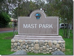
Mast Park - Urban Hiking Santee

One of the communities that calls east San Diego home is Santee.  Santee is home to the fairly well known Mission Trails Regional Park.  The Santee Lakes are a well known recreational area and campground.  The San Diego River Trail passes through both these parks and continues to expand.  I noticed the Canyoneers had a hike planned for Mast Park in Santee.  An area along the San Diego River where I had not hiked before.
IMG_5630 (1280x958)IMG_5648 (1280x927)

Mast Park is the trail head for two trail systems.  A western section of about 6 miles out-n-back along the Carlton Oaks Golf Course, which could be extended to Santee Lakes and Mission Trails.  The east loop is about 3 miles, but can be extended into Wildcat Canyon.  The east loop offers better access to the San Diego River with more opportunities for wildlife viewing.

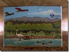
Regardless, the parking area is at Carlton Hills Blvd and the San Diego River.  The murals located on the trail as it passes under the roadway were a project of Boy Scout Troop 51.  Kudos for taking on such an effort.
IMG_5632 (1280x959)IMG_5633 (1280x960)

Mast Park has a large playground, basketball court, an offleash dog area, a frisbee golf course, restrooms along with picnic areas.  Dogs on leash are welcome on all trails.
IMG_5637 (1280x944)IMG_5643 (1280x960)

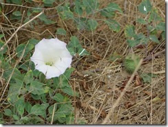
The park is home to a large variety of plants.  The beautiful datura smells like peanut butter, but take a good deep breath and you can feel your airways starting to close!  All forms of the datura are poisonous, especially the flower and the thorn-apple seed seen in the second picture. 
IMG_5641 (1280x959)IMG_5676 (1280x960)

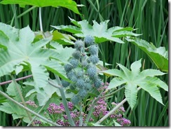
Also found along the trail close to the river is large group of castorbean plants.  Properly prepared castor oil does have its benefits, however it can become the deadly poison ricin.
IMG_5645 (1280x960)IMG_5647 (1280x959)

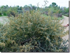
With Canyoneer Jerry in the lead we approach a large saltbush, which has an ammonia odor.
IMG_5654 (1280x959)IMG_5655 (1280x960)

I don’t recall what this beautiful purple plant is, but it has the most noxious order!  Along much of the trail are the little cocklebur plants.  A bit of care may be needed to prevent their little velcro hooks from grabbing onto my socks.
IMG_5657 (1280x941)IMG_5663 (1280x946)

I do not have a picture of the poison oak, but I have to say I don’t think I’ve ever had this variety of plant life trying to get me in such a short distance.

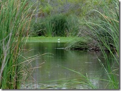
Along the San Diego River a lot of water fowl can be seen.  The Great Egret (with its yellow beak) was a bit closer than its much smaller cousin, the Snowy Egret (with its black beak).
IMG_5664 (1280x949)IMG_5675 (1280x959)

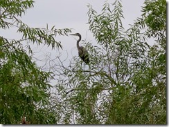
A Great Blue Heron flew overhead and landed in a nearby branch, where he was content to check things out.
IMG_5660 (1280x899)IMG_5661 (1280x959)

There were quite a gathering of chatty mallard ducks, and the ever present coot.
IMG_5669 (1280x929)IMG_5659 (1280x944)

Also managed to capture one of the many hummingbirds and a commarnat in flight.
IMG_5653 (1280x959)IMG_5652 (1280x887)

It was a nice easy walk with Jerry as a very knowledgeable guide.

February 26, 2017

Kumeyaay Lake - Urban Camping San Diego

Kumeyaay Lake Campground is located within Mission Trails Regional Park offering dry camping on weekends.
IMG_2447 (1280x950)IMG_2448 (1280x947)

The campground is about 2.5 miles east of the Mission Trails Visitor Center on Father Junipero Serra Trail.

Although the campground is only available to guests on weekends, the day use parking is always available and it is just a short walk to the lake.  The entire Mission Trails Park is part of the former Camp Elliott for munitions training during WWII.
IMG_2449 (1280x947)IMG_2450 (1024x734)

The last munitions found here were in the early 80’s, with sweeps every 5 years since that have not found any additional ordinance.  Still it is wise to know the history and be aware to the possibility of additional finds. 

The trails are wide, safe and well marked.  Views of the lake and waterfowl are common from the campground.
IMG_2452 (1024x756)IMG_2453 (1024x767)

Although we saw numerous birds, the lone Jackalope is the only land creature we saw despite the perfect habitat.
IMG_2454 (1024x767)IMG_2463 (1024x768)

Not sure what this sign meant so a bit of investigation was required.
IMG_2464 (1024x758)IMG_2467 (1024x768)
IMG_2465 (1024x767)IMG_2466 (1024x768)

I’m going with idea the trail is closed ‘ahead’.  Still this trail to the amphitheater offers some of the best views of the lake.

Although our neighbors look a bit like modern Gypsies they were all very nice as they make their way as full time travelers in a converted school bus.  They do not document their stays and suggested they might want to consider doing so.
IMG_2475 (1024x736)

There are 5 named peaks within Mission Trails.  Bag all 5 and the park will provide a certificate.  I’ll have to start over since I have not done any selfies at each summit to prove the accomplishment.  Well starting over from 1 is not that big of a deal Smile
IMG_2476 (1024x766)IMG_2477 (1024x767)

The reason for selecting this destination was the monthly Star Party.  The San Diego Astronomical Association had 3 telescopes and 2 sets of Celstron celestial binoculars available for use.  Uranus was visible as a blue smudge but did not turn out in my lame camera nor did Andromeda.  Here’s a picture of Mars (a bit blurred) and a decent shot of the Orion Nebula, both taken with my little point-n-shoot Canon G16.
IMG_2479 (1024x721)IMG_2480 (1024x719)

Orion without the benefit of magnification.
IMG_2486 (1024x714)

The Grand-girls came down Saturday for a bit of exploring.  Kg is our documentarian, and is as at home behind the camera as anybody.  I did not see what Kg was looking at as I was impressed with the reflections in the water
IMG_2497 (1024x768)IMG_2498 (1024x768)

A lone dead coastal oak marks the entrance to the trails on the north side of the lake and the grasslands I’ve hiked before.  Seeing so much green is beautiful, but I cannot help but think of the tinder for the next fire season.
IMG_2500 (1024x750)IMG_2502 (1024x761)

We intend to hike into Oak Canyon and follow it to the Old Mission Dam.  This is my 4th time into the canyon, but there was not a drop of water the last two times.  It’s indeed flowing big time this trip.
IMG_2508 (1024x768)IMG_2510 (1024x767)
IMG_2511 (1024x768)IMG_2513 (1024x767)
IMG_2523 (1024x756)

The Mission Dam has been rebuilt several times.  The original brick tiles can be seen in this photo, overlayed with concrete and then rocks and more concrete.  The dam was built in the early 1800s to offer a reliable water supply the the growing San Diego Mission.
IMG_2525 (1024x768)IMG_2526 (1024x730)
IMG_2528 (1024x768)IMG_2532 (1024x768)

After a 3+ mile loop we’re back at the campsite playing a card game called Hike.  And ready for an early dinner of carnitas tacos – YUM! and a challenge of Trivial Pursuit National Parks.
IMG_2536 (1024x741)IMG_2542 (1024x765)

A few of the wildflowers seen along the way.
IMG_2456 (1024x768)IMG_2461 (1024x767)
IMG_2462 (1024x767)IMG_2504 (1024x766)
IMG_2527 (1024x767)

Single use plastic bags are no longer provided and reusable bags are required.  Daughter, Kami made several from the rainfly of their old tent.  Clever, strong and unique.  She knows what I want for Christmas!
IMG_2543 (1024x768)