Welcome!

Welcome and thanks for stopping by.
My reference links will open in a new tab.

If you have any corrections, suggestions, comments please use the Comments at the end of the post.
I do respond to all comments. - Thanks!
Showing posts with label Los Penasquitos Canyon. Show all posts

January 11, 2018

After it rains – where to hike in San Diego

… Waterfalls!  There are quite a few seasonal waterfalls within San Diego County.  I've listed a few of the more urban ones.

Los Peñasquitos Canyon Preserve

If we were home this week I suspect I’d come up here to check out the falls.
IMG_3659IMG_1030

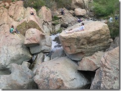
Peñasquitos (meaning little cliffs) contains the closest waterfall to San Diego.  I prefer to hike west to east up the canyon, where is easy FREE parking, rather than the crowded pay parking at the east end of the canyon. I’ve blogged this route HERE.

The canyon and waterfalls can also be accessed from the Del Mar Mesa Preserve. I’ve blogged this route HERE.

Cedar Creek Falls

IMG_2035IMG_2037

Really the best if not only time to consider doing this is after a decent rain. This is probably the best known of the San Diego waterfalls, so popular that permits are required to do this day hike. In my blog on this hike HERE, I also have the link to obtain a permit.  I checked and there are permits available!

Mission Trails Regional Park

This would be my second choice for a local waterfall.  This probably should be highest on the list since I have not yet seen water at the falls …
IMG_2511IMG_2522

At the north end of Oak Creek there is a seasonal waterfall, almost right under highway 52.  When we were here with the grand-girls last February there was more water in Oak Creek than I’d seen in some time.  I’ve blogged the adventure HERE.


The snow birds that are now in the Anza Borrego area have a few options also.

Maidenhair Falls

The trail to Maidenhair Falls can be hiked up from Hellhole Canyon or down from Pena Spring. As the Nimble Hiker noted in their attempt to locate the falls from the canyon, it’s pretty hard to find without water flowing. You can find their details on Oh, the Places They Go! HERE.

You can find my route, which is down to the falls from Pena Spring HERE.  Just follow the water to the top of the falls, and then it’s a rock scramble down.
DSC01105

Coyote Canyon

DD 2nd crossing
My dad and his dog, Patsy, at the second crossing.  This was his last trip up Coyote Creek, I’ve scattered both their ashes off the eastern side of Fonts Point where they can enjoy the sunset.

After a rain Coyote Creek will be flowing deep into Coyote Canyon before joining the aquifer. This is an adventure that requires a capable 4x4 high clearance vehicle.  I have seen pictures of some early wildflowers that are being reported at the 3rd crossing earlier this week.  Check with the VC for current road/trail conditions.

Borrego Palm Canyon

Palm Canyon

Everybody does this hike with the hope of seeing the Borrego Sheep on the hillsides.  We like to do this as an upside down lollipop.  Going up the popular floor of the canyon in the morning and returning along the western slope trail when the floor of the canyon is more crowded.  We had a lot of water when we were last here with the grand-girls.

I'll remain in San Felipe for the coming week.


June 05, 2017

Del Mar Mesa Preserve - San Diego Urban Hiking

After a week in Mexico and 3 weeks of house guests and with RoadTrip 2017 delayed a week, I thought I’d take advantage of the cool Monday morning and the June Gloom to take a little hike at Torrey Pines Preserve.  The needles of the Torrey Pines turn upwards to capture the dew and there is plenty of that this morning.  But I have the windshield wipers on as I’m about to get off I-5, this is way past dew!  Turning east on CA-56 I look to at least get out of the mist.

CA-56 follows the north rim of Los Peñasquitos Canyon.  I’ve hiked the west side before so I'll go over several miles to Black Mountain Rd and look for an alternative entrances.  Ta-Da - there are lots of places to drop in off Park Village Road, only Camino Sur has facilities (porta potties at the park).
IMG_3632 (1280x960)DMMP

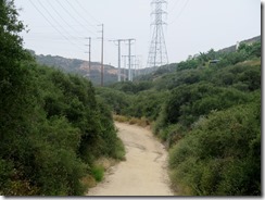
The trails are marked, but I do not have a map, I took the map above off the internet after I returned.  I have not hiked to Del Mar Mesa before so this is a great serendipitous find for this morning.  I find I am on Powerlines and just over a mile to the Los Penasquitos Canyon waterfall, which we hiked last.  The blog is HERE.  The trail is called Powerlines for a reason, but at least I’ll be able to find the way back.
IMG_3633 (1280x960)IMG_3635 (1280x958)

The trails within the canyon are wide and easy hiking.  The green grasses of spring are replaced with fields colored California Gold.
IMG_3643 (1280x959)IMG_3644 (1280x960)
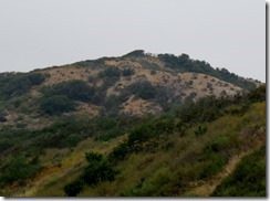
There’s still color on the hills and I see the overlook at Del Mar Mesa while continuing the short distance to the waterfall.

IMG_3648 (1280x960)IMG_3649 (1280x952)

On the canyon floor the fields of grass are still rich green near Penasquitos Creek.  Along the creek there is poison oak, not at all uncommon in San Diego.  I’ve yet to see another person on the trails, but I do see a tiny jack-a-lope hiding in the grass.  The grass and dirt provide a near perfect camouflage, but the ears give him away.
IMG_3651 (1280x959)IMG_3654 (1280x959)
IMG_3655 (1280x960)IMG_3656 (1280x959)

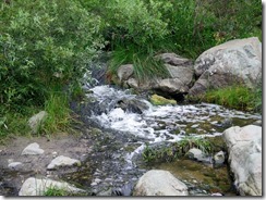
Not much of a waterfall despite our wet winter, but this is SoCal and flowing water is not a year round treat.
IMG_3658 (1280x960)IMG_3659 (1280x959)

The bench is in need of a fresh stain, but is a welcome break.  The sign here indicates that this trail system will become part of the Trans-County Trail.
IMG_3661 (1280x960)IMG_3664 (1280x960)

The side trails leading out of the canyon are not as wide and often used by mountain bikers.  Stay right and if you hear ‘On your left’ step on the trail to your right and let the bikers pass.  I had no more than started up this single track when I hear the call.  I’m not alone as there are a pair of bikers out this gloomy Monday morning.  In theory the bikers should yield, but I would never expect them to.
IMG_3665 (1280x960)IMG_3666 (1280x959)
IMG_3685 (1280x960)IMG_3686 (1280x960)

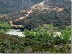
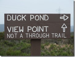
This this section leads up to the Duck Pond, where I can hear but do not see the coots.  Do not see any poly wogs either, and have no plans to come back at dusk to see if there are mosquitoes.  Across the pond are the power lines, still heading in the right direction.
IMG_3687 (1280x960)IMG_3690 (1280x954)

And it is time to start UP to the Del Mar Mesa.  This loop might be better done counter-clockwise, coming down this steep section and returning on the wide open trails.  Who-knew?  There are some nice views from the top, and a viewpoint to check out.
IMG_3695 (1280x960)IMG_3699 (1280x959)
IMG_3702 (1280x960)IMG_3705 (1280x960)

The view to the east and the west from the view point.
IMG_3706 (1280x958)IMG_3707 (1280x959)

Returning from the view point I can see where I parked the truck, but not how to get to it.  I am now past the power lines and the nice folks ahead prefer I’d rather not use their sidewalks.  At least they have a nice path around, and it’s probably a shorter route back into the canyon.
IMG_3715 (1280x941)IMG_3714 (1280x947)
IMG_3716 (1280x959)IMG_3722 (1280x960)
IMG_3723 (1280x959)IMG_3721 (1280x959)

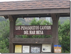
I am finally at my destination, it seems odd this sign is just outside the locked gate and the map is a bit dated, as it does not show the locked gates.
IMG_3724 (1280x957)IMG_3725 (1280x956)

Also just outside the locked gates San Diego Mountain Biking Association (SDMBA) has installed a bike repair stand.
IMG_3727 (1280x960)IMG_3728 (1280x960)

I did see some more locals, including a very active beehive and another bunny.
IMG_3730 (1280x959)IMG_3738 (1280x959)

I was surprised at the number of plants still in bloom.  No wonder the bees were so active.
IMG_3634 (1280x960)IMG_3636 (1280x959)
IMG_3638 (1280x960)IMG_3639 (1280x959)
IMG_3650 (1280x959)IMG_3669 (1280x960)
IMG_3671 (1280x959)IMG_3676 (1280x959)
IMG_3679 (1280x960)IMG_3680 (1280x960)
IMG_3683 (1280x960)IMG_3719 (1280x959)
IMG_3731 (1280x959)IMG_3732 (1280x959)
IMG_3734 (1280x959)IMG_3736 (1280x959)

I doubt if there was more than a couple hundred foot elevation change over the 4 miles but the diversity in both plant and terrain was amazing.